Barguzine Bay
 Barguzine Bay
Source for this data set was the Global Land Cover Facility, www.landcover.org.
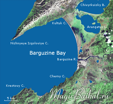
Baikal's largest bay, the Barguzine Bay, begins in the middle of the lake's eastern shores at Cape Krestovy. Forty kilometres later, the striking forested shoreline with numerous capes is replaced by sands that are soon interrupted by the river Barguzine, from the mouth of which the regular swath of a sandy spit stretches north–westwards until it comes up against the mountainous Svyatoi Nos peninsular far off in the distance. The shores of the peninsular, from the point where it meets the sandy spit of the bay up to Cape Nizhnyeye Izgoloviye forms the north–western margin of Barguzine Bay. The indigenous peoples of these places, the Tungus, called the bay Bargunyi–Omon.
Barguzine Bay from north of the Barguzine river mouth and part of the bay's waters belong the Zabaikalsky National Park.
The following figures give one an idea of the size of Barguzine Bay. 90 kilometres from Cape Krestovy to Cape Nizhnyeye Izgoloviye; the distance between these capes framing the bay is some 24¬Ýkm. Barguzine Bay encloses an area of around 790¬Ýkm2.
 Barguzine Bay at Lake Baikal
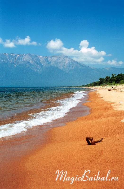
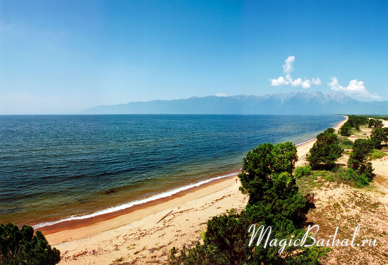
The bay's sandy spit stretches 22 kilometres from the river Barguzine till the Svyatoi Nos peninsular. Immediately after the surf zone, the sandy spit gives way to inviting dunes overgrown by a forest of pine and larch trees. The peculiarity of the sandy parts of Barguzine Bay's shores is in the existence of so–called coastal bars. More than 200 bars (embankments) stretch obliquely towards the bay in the direction of the mouth of the river Barguzine, almost parallel to the Svyatoi Nos peninsular. The bars were formed because of the slow but continuous input of hard sediments and gradual movement of the shoreline deep into the bay. Sediment input occurs because of the weak current along the Barguzine Bay's shore in a northerly direction away from the river mouth.
To the north‚Äìeast, behind the sandy spit, a marshy neck of land begins¬Ý‚Äî the Myagkaya Karga which separates Barguzine Bay from Chivyrkuisky Bay.
It is thought that Barguzine Bay formed as a result of the quick submersion of a large section of dry land. Scientists find conformation for this conjecture in the existence of underwater canyon–like continuations of the valleys of the rivers Barguzine and Maximikha.
 Barguzine Bay
Barguzine Bay, despite its insignificant depth near to the sandy spit, cannot be called shallow. Its depth increases as it goes out from the shore and at its very mouth, not far from the line described by capes Krestovy and Nizhnyeye Izgolovye, closer to the latter, in an underwater trough, it reaches 1284¬Ýmetres, which is only 350¬Ýmetres less than Baikal's maximum depth.
In summer, if the weather is warm and calm, the waters of the bay can warm up to quite a comfortable temperature. The water is particularly warm, up to¬Ý+22¬∞, where the sandy spit of Barguzine Bay meets the Svyatoi Nos peninsular. This place is called Kultuk Bay. During the tourist season masses of tourists gather here, arriving mainly by car: there is a road going along the sandy spit from the Ust‚ÄìBarguzine settlement.
© Magic Baikal