Kobylya Golova Peninsular (Khorin–Irgi)
The peninsula is situated at the western end of the northern coast of Olkhon in Pribaikalskiy National Park. The historical Buryat name is Khorin–Irgi, so called because one of its promontories resembles the profile of a horse's head. The well–known scientist Yan Cherskii, however, discerned «...the skull of an enormous predator, something between a kind of dog and a bear...» in it. There is no doubt that the Kobylya Golova Peninsular is a most remarkable landscape and historical phenomenon, and deserved being awarded the status of a state natural monument in 1981. The peninsula includes some beautiful promontories, bays and even a small but rather unusual lake. A number of archaeological finds have been made there. Traces of human beings on Kobylya Golova go some five thousand years back into the past. Previously, this was a place of religious ritual for the island's inhabitants. Kobylya Golova separates the waters of the Maloye Morye Strait from Khul bay, part of the Olkhonskiye Vorota Straits. Let's take a walk around the promontories and bays of Kobylya Golova.
Cape Kobylya Golova (Khorin–Irgi)
 Kobylya Golova Peninsular (Khorin–Irgi).
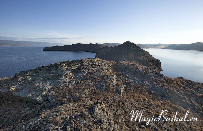 View of Cape Kobylya Golova.
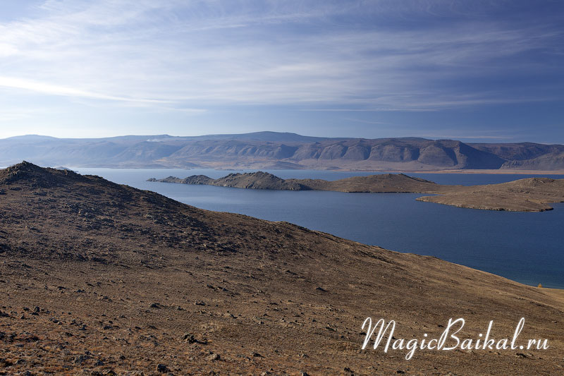
The cape crowning the western tip of Kobylya Golova Peninsula is, at the same time, Olkhon's most westerly point. It was this cape that gave the peninsula its name. In profile, the cape really does resemble the head of some animal. The very end of the cape is broken off from the main part, actually it is an isolated rock separated from Olkhon by a narrow channel only a few metres wide. It is possible to go through this channel in a kayak quite easily in calm weather. The impressive cliffs of the cape look particularly stunning from the water on the northern side¬Ý‚Äî from the side of the Maloye Morye Strait. There is a lighthouse on the cape, that was once the place of religious ritual for the local inhabitants.
Cape Khalte
This promontory is on the northern shore of Kobylya Golova Peninsula. From here a wonderful view of the Maloye Morye, Olkhonskiye Vorota and the Primorskiy mountain range opens up. There are a number of grottos at water level in the rocks of the promontory. Archaeological studies have revealed a religious complex of the 18th‚Äì19th centuries on the cape composed of three stone ¬´obo¬ª in the form of ¬´well¬ª, each measuring 1.3¬Ýmetres by 1.1¬Ýmetre, and some 70 centimetres high.
Cape Tutyrkhei
 View of the islands in the Maloye Morye from the top of Cape Tutyrkhei.
The most easterly promontory on the north side Cape Kobylya Golova. From the water, the tip of the cape looks like a massive rock cliff with an overhanging cornice. A number of archaeological finds have been made here. At the tip of the promontory there is a stone structure in the form of a balcony facing Baikal, about 2x1.5 metres in size. The outer part of this structure is made of slabs, laid in a few layers. The floor of the «balcony» is covered by flat slabs. Adjacent to this, only two metres to the west, is an «obo» in the form of a vertical stone slab. These works date back to the 5th–10th and 17th–19th centuries A.D. A 17th–19th century burial ground has been found in the rocky ridge of the promontory.
Tutyrkhei Bay
The bay is situated on the island of Olkhon to the east of the cape of the same name. The bay goes deep into the island, convenient for camping, as it gives some protection even from the mountain wind. A prehistoric camp has been found in the bay dating back to five to three thousand years B.C.
Kobylya Golova Bay (Khorin–Irgi)
The bay is situated on Olkhon on the northern side of Khul inlet (the first bay in the inlet to the east of Cape Khorin–Irgi). Traces of a prehistoric camp (dating back 5–3 thousand years B.C. and one thousand A.D.) have been found in the bay.
Tangober Bay
The bay is situated on Olkhon on the northern side of Khul inlet. Traces of a prehistoric camp have been found in the bay (dating back 5–3 thousand years B.C and one thousand A.D.).
Lake Nuku–Nur
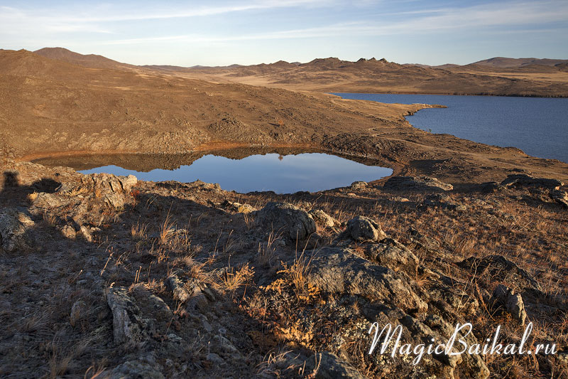 Lake Nuku–Nur on Kobylya Golova Peninsula.
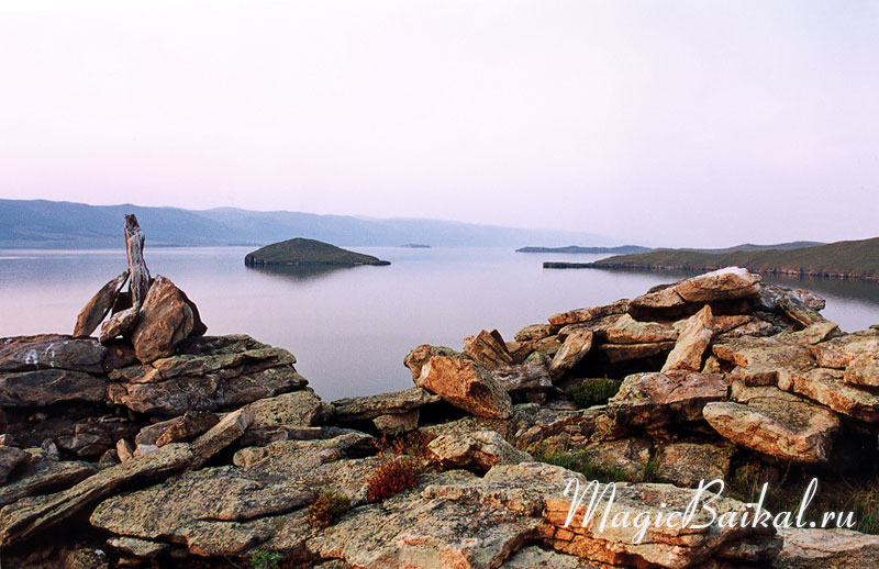
Lake Nuku‚ÄìNur on Kobylya Golova Peninsula.The lake is situated on the island of Olkhon on the Kobylya Golova Peninsula, in the eastern part of Tangober Bay. Separated from Baikal not by a sandy spit, like most lakes close to Baikal's shore, but by a rocky ridge, Lake Nuku‚ÄìNur lies in a rocky crater. In summer the water is very warm, but it's unlikely that anyone would want to bathe in it¬Ý‚Äî the floor of the lake literally teems with life.
One can find other photographs of these locations at Baikal in the Photo baikal–photos section the Island of Olkhon and Maloye Morye Strait.
© Magic Baikal